Bubbles Trail
Videos
Map
Quick Facts
| Difficulty | strenuous |
| Trail Type | linear |
| Distance | 1.6 miles (2.6 km) |
| Estimated Time | 1 hr 30 mins return |
| Surface Type | rock |
| Elevation Change | 459 feet (140 meters) |
| Total Ascent | 805 feet (245 meters) |
| Features | glacial erratics, peaks |
| Trail Markers | blue paint |
| Scenery Rating | must see |
| Maintenance Rating | well maintained |
| Cell Reception | strong |
| Dog Friendly | on a leash |
| Fees | park entrance |
Description
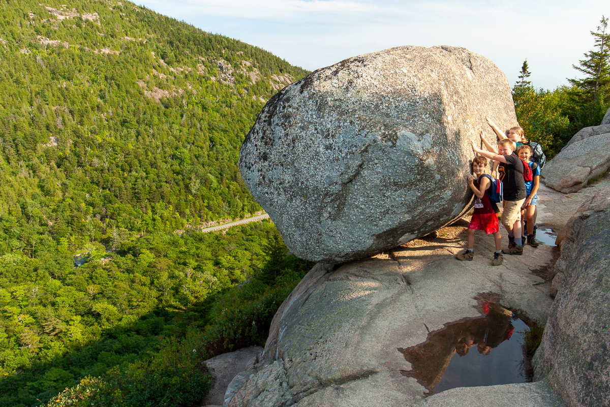
The Bubbles are two rounded mountains between Jordan Pond and Eagle Lake. They provide amazing views of both Jodan Pond and Eagle Lake. The main feature is the large boulder that hangs precariously on the edge of a cliff. Many have tried to push it over but all have failed. If it ever does fall down the slope it is going to cause some damage since the boulder is the size of a car.
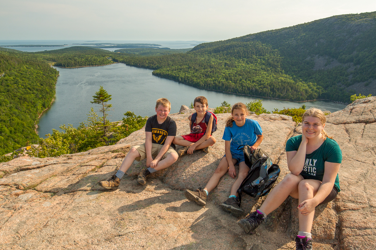
The climb up South Bubble is a lot of rock steps up through large boulders. Near the top there are a few cliffs to climb. On one of them you have to climb up through a narrow crack (see pictures). If you are not comfortable with scrambling and tight spaces then you may want to consider climbing up South Bubble from the Bubble Divide Trail. Once above the cliffs the trail flattens out with some large, wide steps made of logs. The trail then comes out onto a flat granite face that provides the best views of Jordan Pond.

Continue on the trail past the opening. You will soon come out of the stunted softwood trees at the peak of the mountain. You will see the sign marking the peak on the left. A short distance down the tiered cliffs on the right will take you down to Bubble Rock (mentioned above).
Continue on the main trail and you will come to one more lookout facing west before descending to the Bubble Divide Trail. This lookout also provides views of North Bubble Mountain. The Bubble Divde Trail is a valley that splits the two Bubble Mountains. It's at about half the elevation as the peaks.
The climb up to North Bubble is once again mostly rock steps. The first views are facing south towards Jordan Pond. South Bubble is off to the left and in front of part of Jordan Pond. The next lookout is at the peak and provides similar views as the first lookout.
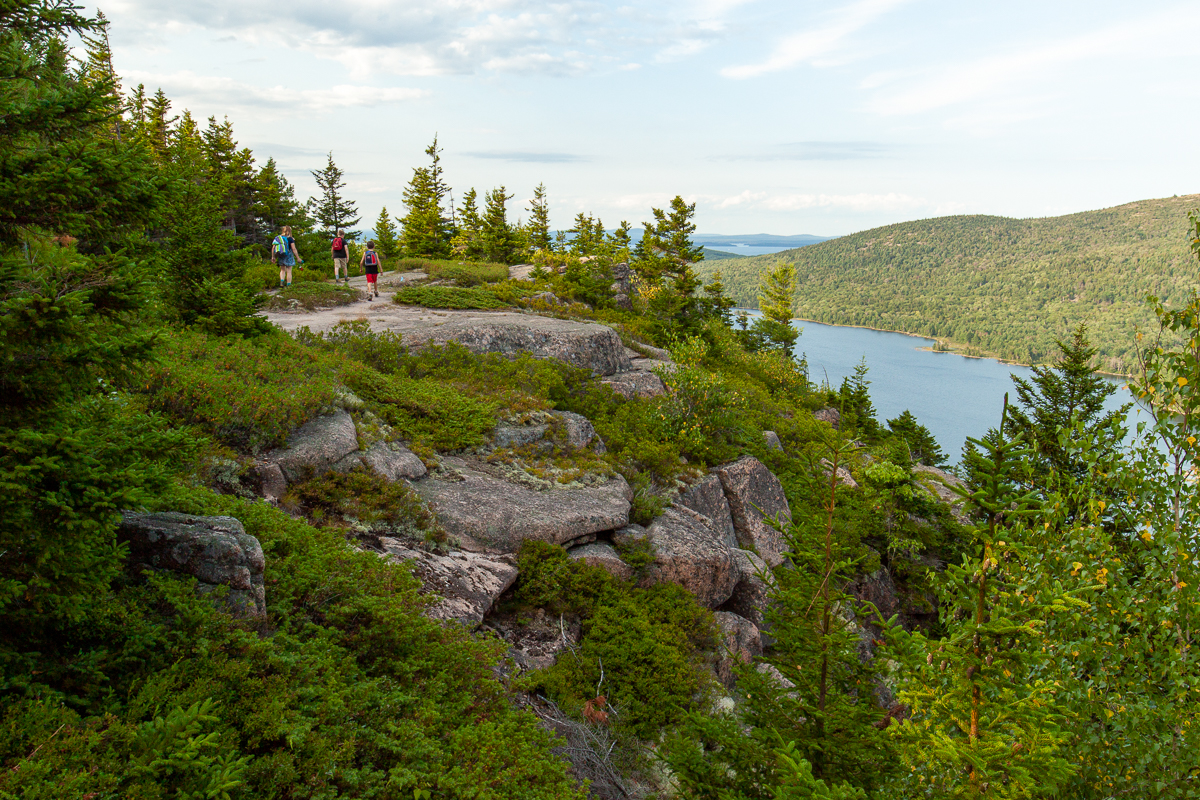
Beyond the peak of North Bubble the trail starts to follow an open ridge that faces east, providing great views of Eagle Lake to the north.
Directions
For directions to the park go to the Acadia National Park page. Please consider using the free bus system in the park to assure you aren't driving around in circles trying to find a place to park. If you do use the buses make sure you plan your hikes so you don't miss the last bus of the day.
When in the park you will need to display a park pass. The best way to get a park pass is at the Sand Beach Entrance Station on the Park Loop Road. From Bar Harbor travel south on Route 3 (Main Street) for 1.7 miles (2.7 km) and then turn right into the park entrance. This short access road will take you to the Park Loop Road. Turn right onto this one-way road. Drive for 2.6 miles (4.2 km) and you will come to the Entrance Station. Buy a pass and continue to drive on the loop road. For more details on park fees go here. Make sure you enjoy all the spectacular views along the way.
Continue on the Park Loop Road for 10.1 miles (16 kilometres) and look for the Bubbles Divide Parking lot on the left. If that parking lot is full you may need to continue for 1.1 miles (1.8 kilometres) to the Bubble Pond Parking Lot on the right. From here you can take the Carriage Road around Eagle Lake to access the trail up North Bubble. If parking is still an issue then you may have to drive back to the Jordan Pond Parking lot and take the Jordan Pond Footpath to access the trail.
Remember that any of these alternative access options will add additional time on your hike so plan accordingly. Remember that using the bus system means you don't have to worry about parking and you can be dropped off and picke up in a different place.
Gallery

Other Trails in the Park
- Trail Last Hiked: August 7, 2017
- Page last updated: March 22, 2020