Abol Trail
Video
Map
Quick Facts
| Difficulty | strenuous |
| Trail Type | linear |
| Distance | 3.4 miles |
| Estimated Time | 8-10 hours return |
| Surface Type | forested, rock |
| Elevation Change | 3,282 feet |
| Features | boulders, views |
| Trail Markers | blue paint |
| Scenery Rating | beautiful |
| Maintenance Rating | well maintained |
| Cell Reception | variable |
| Dog Friendly | no |
| Fees | park entrance |
Description
Parking for the Abol Trailhead is by reservation. You can reserve a parking space on the Baxter State Park website. If reserved parking spots are not claimed by 7am the rangers start to give them out on a first come, first serve basis.
For directions to the park go to the Baxter State Park page.
From the Togue Pond gatehouse keep left and continue on the Park Tote Road for 5.6 miles (9 km) to the Abol Campground. You can park along the road on the left or to the right just past the building. The Abol Trail starts at the back of the campground on the right. After you sign in at the Ranger Station continue on the road that goes up into the campground. After 600 feet (200 meters) you will come to the trailhead. The trail steadily climbs through a mixedwood forest on an old road that travels along Abol Stream.

The trail soon leaves the stream and climbs more steeply through a beautiful hardwood forest until the first opening. Near the bottom of the Abol slide the trail turns to the left. Previous to 2014 the trail continues up the rock slide but a rock slide in made this route very unstable so the trail was rerouted. After a distance to the left the trail begins to switchback. Soon after this the trail starts to open up with views to the south.
At the top of the switchbacks the trail turns back to the right and crosses to the top of the rock slide. From here you can clearly see the damage caused by the 2014 rock slide. At this point the trail becomes a scramble up over large bouders to the plateau. There is only one place where it is difficult to climb up through the rocks. It's not high, just awkward.
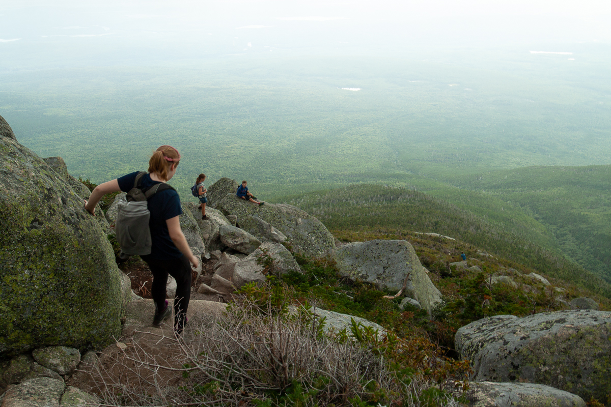
Once on the plateau the trail continues for another 600 feet (200 meters) to the junction with the Hunt Trail. Turn right on the Hunt Trail to cross the plateau to Baxter Peak.
The Abol Trail is the most direct route to the peak.
Always be cautious of weather when you are going above treeline.
Directions
For directions to the park go to the Baxter State Park page.
From the Togue Pond Gatehouse keep left and travel 5.6 miles (9 km) on the Park Tote Road. You will come to the Abol Campground on the right. Park along the road on the left. The Park Tote Road is gravel and is quite narrow and twisty turny. Use caution on and drive slow on this road.
Gallery


Other Trails in the Park
- Cathedral Trail
- Chimney Pond Trail
- Doubletop Mountain Trail
- Dudley Trail
- Hamlin Ridge Trail
- Helon Taylor Trail
- Hunt Trail
- Knife Edge Trail
- Marston Trail
- Mount Coe Trail
- North Basin Trail
- Northwest Basin Trail
- Saddle Trail
- Traveler Loop Trail
- Trail Last Hiked: September 3, 2018
- Page last updated: October 12, 2019