Hunt Trail
Video
Map
Quick Facts
| Difficulty | difficult |
| Trail Type | linear |
| Distance | 4.7 miles (7.5 km) |
| Estimated Time | 10 to 12 hours return |
| Surface Type | forested, rock |
| Elevation Range | 4,401 feet |
| Features | peak, ridges |
| Trail Markers | white paint |
| Scenery Rating | beautiful |
| Maintenance Rating | well maintained |
| Cell Reception | variable |
| Dog Friendly | no |
| Fees | park entrance |
Description
The Hunt Trail is the last section of the Appalachian Trail. This trail requires a lot of scrambling and maneuvering around small cliffs. If you are afraid of heights you may want to start with the Saddle or Abol Trails. My upper body was more sore than my legs after this hike.
The trail starts to gently climb on an old road. Soon the road becomes more rocky and rooty. Just before you reach the bridge over Katahdin Stream you will pass by the trail junction with The Owl Trail. By the time you reach the bridge over Katahdin Stream you will be passing by large boulders.
If you are taking the alternate access trail you will gently climb through the woods until you reach Katahdin Stream Falls. You will pass by a few large boulders on the way.
Near the bridge (or location where the bridge used to be) there is an outhouse. Keep in mind that this is the last place to use the bathroom that is not exposed. Just past the bridge the trail climbs up over a granite face and soon comes to Katahdin Stream Falls. There is a nice lookout overlooking the falls down the hill to the left of the trail but be careful. It is still a long drop to the stream below so stay back from the edges.

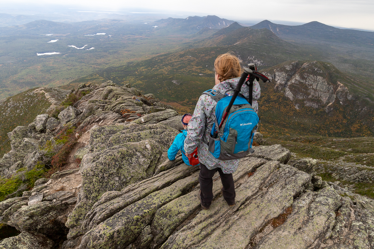
Continue up the many rock stairs. After a while you will start to scramble up over large boulders. One is laying on another one making a small cave. After a bit of scrambling you will come to the first views near treeline. From treeline the trail is a scramble that is difficult in places. There are a few places with iron rungs or steps to help. The Owl is the closest mountain with the most exposed cliffs. The next mountain from right to left is mount OJI and Doubletop with a flat top in the distance. You can also see South Brother and North Brother behind OJI. South Brother is the one with striped forest.
There is one large slanted rock face that you climb and then have to work around an overhang at the top (see picture here). On our last hike we accidentally found a side trail that works along the bottom of the cliff face on the right. It climbs in a much easier loop that comes out at the top of the cliff (see the orange side trail on the map).
The trail comes to a ridge with the most amazing views. The ridge is a short reprieve from the scrambling up to the tablelands. Once you reach the tablelands it takes another mile to cross the tablelands to get to Katahdin Peak. The trail passes by the Abol Trail on the way to the peak.

Always be cautious of weather when you are going above treeline.
Directions
For directions to the park go to the Baxter State Park page.
Parking for the Hunt Trail is by reservation. You can reserve a parking space on the Baxter State Park website. If reserved parking spots are not claimed by 7am the rangers start to give them out on a first come, first serve basis. You may get lucky but it's always good to have a plan B.
From the Togue Pond Gate keep left and continue on the Park Tote Road for 7.9 miles (12.7 km) until you come to the Katahdin Stream Campground. As you drive into the campground you can park on the left along the road. Continue to the left along the road passing the outhouse and you will soon come to the trail head. Sign in and start your hike.

Note: When we were there last in September 2019 the bridge was out near Katahdin Stream Falls. An alternative access trail (see map) was used to access the main trail near the falls. To get to it cross the walking bridge over the stream on the right as you enter the campground. Walk up the road that passes the ranger station and you will soon come to a trailhead on the left. Sign in and then start your hike.
Gallery

- Trail Last Hiked: September 28, 2019
- Page last updated: October 12, 2019
Other Trails in the Park
- Abol Trail
- Cathedral Trail
- Chimney Pond Trail
- Doubletop Mountain Trail
- Dudley Trail
- Hamlin Ridge Trail
- Helon Taylor Trail
- Knife Edge Trail
- Marston Trail
- Mount Coe Trail
- North Basin Trail
- Northwest Basin Trail
- Saddle Trail
- Traveler Loop Trail